Park nearby Dunham Park
Coronavirus disease (COVID-19) Situation
confirmed cases
2621111
deaths
5697
New Zealand
Park nearby Dunham Park
Dunham Park
Tokoroa New Zealand
contacts phone
:
+64
Latitude:
-38.2143795
, Longitude:
175.8714916
read more
nearest Park
915 m
Watermark
Whakauru Street, Tokoroa
Park
read more
1.198 km
Stanley Park
Tokoroa
Park
read more
1.576 km
Ireland Reserve
Tokoroa
Park
read more
1.863 km
Matarawa Park
Tokoroa
Park
read more
2.171 km
Glenkill Park
Tokoroa
Park
read more
2.396 km
James Higgins Park
Tokoroa
Park
read more
2.589 km
Strathmore Park
Tokoroa
Park
read more
2.594 km
Benalder Reserve
Tokoroa
Park
read more
2.703 km
Lake Moananui Reserve
234 Maraetai Road, Tokoroa
Park
read more
3.408 km
Tokoroa Kart Track
Tokoroa
Park
read more
7.724 km
Jim Curry Reserve
5054 State Highway 1, Kinleith
Park
read more
40.058 km
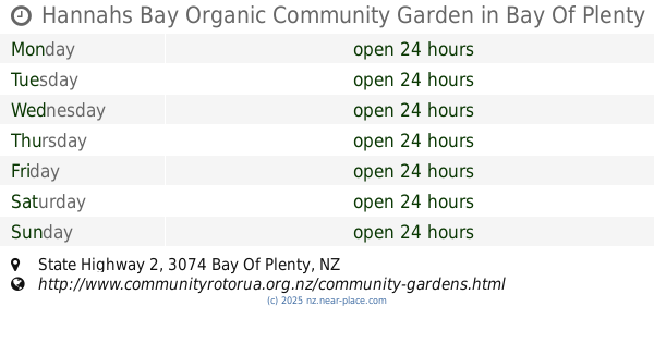
Hannahs Bay Organic Community Garden
38°06'40. 176°18'37.9"E, State Highway 2
Park
read more
45.129 km
Bedford Park
Matamata
Park
read more
45.337 km
Jaycee Reserve
Matamata
Park
read more
51.487 km
Memorial Park
Leamington
Park
read more
51.681 km
Huka Falls Lookout
Loop Road, Wairakei
Park
read more
51.982 km
Hiskens Place Reserve
Te Awamutu
Park
read more
52.329 km
Chatsfield Drive Reserve
Te Awamutu
Park
read more
52.417 km
Te Rahu Road Reserve
Te Awamutu
Park
read more
53.203 km
War Memorial Park
Te Awamutu
Park
read more
53.838 km
Waikato Expressway
Section, State Highway 1, Cambridge
Park
read more
61.781 km
Donovan Park
Papamoa Beach
Park
read more
62.449 km
Te Puke Community Garden
Jocelyn Street, Te Puke
Park
read more
66.562 km
Hammond Park
Riverlea
Park
read more
66.881 km
Hamilton Car Club
116 Vaile Road, Newstead
Park
read more
📑
all categories
Accounting
Administrative area level 1
Administrative area level 2
Airport
Amusement park
Aquarium
Art gallery
Atm
Bakery
Bank
Bar
Beauty salon
Bicycle store
Book store
Bowling alley
Bus station
Cafe
Campground
Car dealer
Car rental
Car repair
Car wash
Casino
Cemetery
Church
City hall
Clothing store
Colloquial area
Convenience store
Country
Courthouse
Dentist
Department store
Doctor
Electrician
Electronics store
Embassy
Establishment
Finance
Fire station
Florist
Food
Funeral home
Furniture store
Gas station
General contractor
Grocery or supermarket
Gym
Hair care
Hardware store
Health
Hindu Temple
Home goods store
Hospital
Insurance agency
Jewelry store
Laundry
Lawyer
Library
Light rail station
Liquor store
Local government office
Locality
Locksmith
Lodging
Meal delivery
Meal takeaway
Mosque
Movie rental
Movie theater
Moving company
Museum
Natural feature
Neighborhood
Night club
Painter
Park
Parking
Pet store
Pharmacy
Physiotherapist
Place of worship
Plumber
Point of interest
Police
Political
Post office
Premise
Real estate agency
Restaurant
Roofing contractor
Route
Rv park, camping
School
Shoe store
Shopping mall
Spa
Stadium
Storage
Store
Subpremise
Supermarket
Synagogue
Taxi stand
Train station
Transit station
Travel agency
University
Veterinary care
Zoo
sublocality level 1
↑