Store nearby Taupo Gas Company
New Zealand
Store nearby Taupo Gas Company
Taupo Gas Company
50 Huia Street, Huia, Taupo Neuseeland
contacts phone
:
+64
Latitude:
-38.6929155
, Longitude:
176.0855578
read more
nearest Store
256 m
David Skeen
Huia Street, Taupo
Store
read more
258 m
David & Jenny Skeen
Huia Street, Taupo
Store
read more
327 m
Tulloch Transport
63 Gillies Avenue, Taupo
Store
read more
336 m
Clayton Merz Plumbing & Drainage
214 Tamamutu Street, Taupo
Store
read more
420 m
Strange's Dental Group
179 Tamamutu Street, Taupo Town Centre
Store
read more
550 m
Rpmallets
65 Taupo View Road, Taupo
Store
read more
551 m
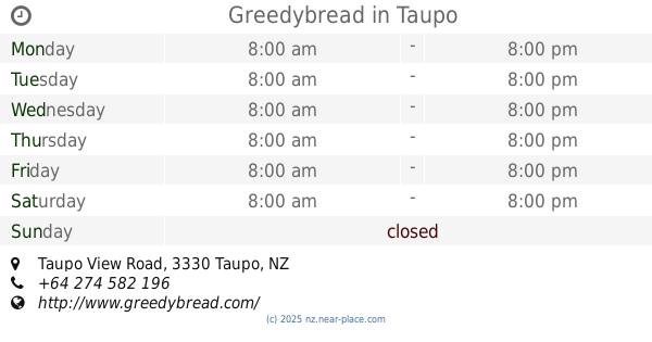
Greedybread
Taupo View Road, Taupo
Store
read more
609 m
3 Little Kiwis Gelato Cart
120/146 Lake Terrace, Taupo
Store
read more
650 m
Hibiscus Surf School
16 Taupo View Road, Taupo
Store
read more
669 m
Is This Love?
11 Marama Arc, Taupo
Store
read more
669 m
Jennian Homes Taupo
101 Tamanupu Street, Taupo
Store
read more
669 m
Guides New Zealand - Waiariki Region
Pererika St, Taupo
Store
read more
715 m
Concept Video
344 Hatepe Avenue, Taupo
Store
read more
764 m
Svend Erik Skovs Chocolate Factory
Koha Road, Taupo
Store
read more
877 m
Vendella International
15 Laughton Street, Taupo
Store
read more
913 m
Unichem Taupo Health Center Pharmacy
113 Heu Heu Street, Taupo
Store
read more
947 m
Bujinkan Hiryu Dojo Taupo
Pihanga Street, Tauhara, Taupo
Store
read more
950 m
Whaiora Goodness
108 Tuwharetoa Street, Taupo
Store
read more
958 m
Kiwi Clothing Corner
Heuheu Street, Taupo
Store
read more
1000 m
Lush Grass Limited
Rotokawa Street
Store
read more
1.061 km
The Lake Gallery / Framed
6 Motutaiko Street, Taupo
Store
read more
1.15 km
Black Dogs Printing Company
75 Titiraupenga Street, CBD
Store
read more
1.247 km
Paetiki Lotto Magazines & Post
230 Taharepa Road, Tauhara, Taupo
Store
read more
1.263 km
Farmers Discount Meats Limited
203 Rifle Range Road, Tauhara, Taupo
Store
read more
1.328 km
Rebel Sport
12 Taniwha St, Taupo
Store
read more
📑
all categories
Accounting
Administrative area level 1
Administrative area level 2
Airport
Amusement park
Aquarium
Art gallery
Atm
Bakery
Bank
Bar
Beauty salon
Bicycle store
Book store
Bowling alley
Bus station
Cafe
Campground
Car dealer
Car rental
Car repair
Car wash
Casino
Cemetery
Church
City hall
Clothing store
Colloquial area
Convenience store
Country
Courthouse
Dentist
Department store
Doctor
Electrician
Electronics store
Embassy
Establishment
Finance
Fire station
Florist
Food
Funeral home
Furniture store
Gas station
General contractor
Grocery or supermarket
Gym
Hair care
Hardware store
Health
Hindu Temple
Home goods store
Hospital
Insurance agency
Jewelry store
Laundry
Lawyer
Library
Light rail station
Liquor store
Local government office
Locality
Locksmith
Lodging
Meal delivery
Meal takeaway
Mosque
Movie rental
Movie theater
Moving company
Museum
Natural feature
Neighborhood
Night club
Painter
Park
Parking
Pet store
Pharmacy
Physiotherapist
Place of worship
Plumber
Point of interest
Police
Political
Post office
Premise
Real estate agency
Restaurant
Roofing contractor
Route
Rv park, camping
School
Shoe store
Shopping mall
Spa
Stadium
Storage
Store
Subpremise
Supermarket
Synagogue
Taxi stand
Train station
Transit station
Travel agency
University
Veterinary care
Zoo
sublocality level 1
↑