places in Levin
New Zealand
Levin
Levin
Administrative Region:
Manawatu-Wanganui
population:
21 200
calling code:
+64-6
postcode:
5510
5570-5572
5574-5575
Location on the map of New Zealand
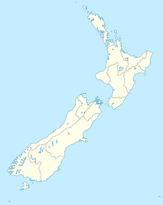
Levin
Police
NZ Police
7 Bristol Street, Levin
Police
read more
Church
Levin Seventh Day Adventist Church
56 Cambridge Street, Levin
Church
read more
Advancing His Kingdom Ministries - Levin Church
155 Bartholomew Road, Horowhenua, Levin
Church
read more
St Joseph's Catholic Church
56 Weraroa Road, Levin
Church
read more
Queen Street Chapel
541 Queen Street, Horowhenua, Levin
Church
read more
Encounter Levin
50 Cambridge Street, Horowhenua, Levin
Church
read more
Sacred Monastery of The Holy Archangel
495 Gladstone Road, Levin
Church
read more
LifeChangers
87/89 Cambridge Street, Levin
Church
read more
Kingdom Hall of Jehovah's Witnesses
25 McKenzie Street, Levin
Church
read more
Levin Baptist Kindergarten
19 Rugby Street, Horowhenua, Levin
Church
read more
St Mary's Family Church
120 Cambridge Street, Levin
Church
read more
Baptist Church
17/19 Rugby Street, Horowhenua, Levin
Church
read more
Assembly of God
131/133 Liverpool Street, Horowhenua, Levin
Church
read more
Levin Baptist Church
Rugby Street, Levin
Church
read more
Levin Uniting Church
87 Oxford Street, Horowhenua, Levin
Church
read more
Levin Faith Centre
136 Queen Street, Horowhenua, Levin
Church
read more
Liquor store
Thirsty Liquor
1 Makomako Road, Horowhenua, Levin
Liquor store
read more
Liquorland Levin
6 Exeter Street, Horowhenua, Levin
Liquor store
read more
Super Liquor
122-124 Oxford Street, Horowhenua, Levin
Liquor store
read more
Movie theater
Focal Point Cinema & Cafe
14-16 Salisbury Street, Levin
Movie theater
read more
Book store
Touchwood Books Growers Bookshop
1092 Queen Street East, Horowhenua, Levin
Book store
read more
Paper Plus
201 Oxford Street, Horowhenua, Levin
Book store
read more
📑
Levin all categories
Accounting
Administrative area level 2
Airport
Art gallery
Atm
Bakery
Bank
Bar
Beauty salon
Bicycle store
Book store
Bus station
Cafe
Car dealer
Car repair
Cemetery
Church
Clothing store
Convenience store
Dentist
Department store
Doctor
Electrician
Electronics store
Establishment
Finance
Fire station
Florist
Food
Funeral home
Furniture store
Gas station
General contractor
Grocery or supermarket
Gym
Hair care
Hardware store
Health
Home goods store
Hospital
Insurance agency
Jewelry store
Laundry
Library
Liquor store
Local government office
Locality
Locksmith
Lodging
Meal delivery
Meal takeaway
Movie theater
Museum
Natural feature
Painter
Park
Parking
Pet store
Pharmacy
Place of worship
Plumber
Point of interest
Police
Post office
Premise
Real estate agency
Restaurant
Roofing contractor
Route
School
Shoe store
Shopping mall
Spa
Storage
Store
Supermarket
Train station
Travel agency
University
Veterinary care
sublocality level 1
↑