Park nearby Hamurana Reserve Playground
New Zealand
Park nearby Hamurana Reserve Playground
Hamurana Reserve Playground
Hamurana Nowa Zelandia
contacts phone
:
+64
Latitude:
-38.0348136
, Longitude:
176.2521673
read more
nearest Park
3.985 km
Taniwha Spring
Awahou,, Rotorua
Park
read more
5.471 km
Reeme Street Reserve
Reeme Street, Ngongotaha, Rotorua
Park
read more
5.498 km
Ngongotaha Lakefront Reserve
Ngongotaha
Park
read more
6.098 km
Jessie Martin Park
Ngongotaha
Park
read more
6.991 km
Tamarahi Reserve
Ngongotaha
Park
read more
7.538 km
Agrodome Leisure Park
141 Western Road, Ngongotaha, Rotorua
Park
read more
8.261 km
Wingspan National Bird of Prey Centre
1334 Paradise Valley Road, Ngongotaha Valley
Park
read more
8.83 km
Rotorua Canopy Tours
147 Fairy Springs Road, Fairy Springs, Rotorua
Park
read more
9.564 km
Cherry blossoms
Fairy Springs, Rotorua
Park
read more
9.907 km
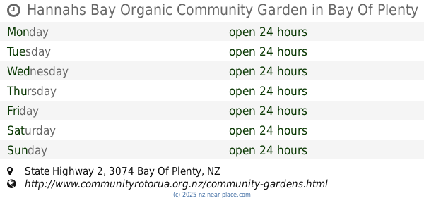
Hannahs Bay Organic Community Garden
38°06'40. 176°18'37.9"E, State Highway 2
Park
read more
10.219 km
Waingaehe Park
Holdens Bay
Park
read more
10.704 km
Playground
Lakefront Drive, Rotorua
Park
read more
10.777 km
Village Green
Rotorua
Park
read more
11.117 km
Government Gardens
Nueva Zelanda
Park
read more
11.123 km
Klamath Falls Rose Garden
Rotorua
Park
read more
11.556 km
Linton Park
Mangakakahi, Rotorua
Park
read more
11.675 km
Puketawhero Park
482 Te Ngae Road, Owhata, Rotorua
Park
read more
11.746 km
Chaucer Place Reserve
Chaucer Place, Owhata, Rotorua
Park
read more
12.08 km
Corlett Street Reserve
Utuhina
Park
read more
12.123 km
Pullar Park
Fordlands, Rotorua
Park
read more
12.654 km
Puarenga Park
200 Te Ngae Road, Ngapuna, Rotorua
Park
read more
12.727 km
Hodgkins Street Reserve
Pukehangi
Park
read more
13.41 km
Ray Boord Park
Westbrook, Rotorua
Park
read more
13.988 km
Arikikapakapa Reserve
Whakarewarewa, Rotorua
Park
read more
14.157 km
Jackson Park
Springfield, Rotorua
Park
read more
📑
all categories
Accounting
Administrative area level 1
Administrative area level 2
Airport
Amusement park
Aquarium
Art gallery
Atm
Bakery
Bank
Bar
Beauty salon
Bicycle store
Book store
Bowling alley
Bus station
Cafe
Campground
Car dealer
Car rental
Car repair
Car wash
Casino
Cemetery
Church
City hall
Clothing store
Colloquial area
Convenience store
Country
Courthouse
Dentist
Department store
Doctor
Electrician
Electronics store
Embassy
Establishment
Finance
Fire station
Florist
Food
Funeral home
Furniture store
Gas station
General contractor
Grocery or supermarket
Gym
Hair care
Hardware store
Health
Hindu Temple
Home goods store
Hospital
Insurance agency
Jewelry store
Laundry
Lawyer
Library
Light rail station
Liquor store
Local government office
Locality
Locksmith
Lodging
Meal delivery
Meal takeaway
Mosque
Movie rental
Movie theater
Moving company
Museum
Natural feature
Neighborhood
Night club
Painter
Park
Parking
Pet store
Pharmacy
Physiotherapist
Place of worship
Plumber
Point of interest
Police
Political
Post office
Premise
Real estate agency
Restaurant
Roofing contractor
Route
Rv park, camping
School
Shoe store
Shopping mall
Spa
Stadium
Storage
Store
Subpremise
Supermarket
Synagogue
Taxi stand
Train station
Transit station
Travel agency
University
Veterinary care
Zoo
sublocality level 1
↑